It’s natural for me as a photographer to want to show and share with you images of the many beautiful subjects I come across in Nepal, just as it is natural for me to gravitate towards them. And I dare say, I’m not so different from any foreigner who comes here: we tend not to come for the air pollution, the noise pollution, the water pollution, or to witness the squalor and struggle in which many people in this country exist. But for me to continue sharing only these things of beauty with you – the noble Mongolian face against the white Himalaya backdrop, be it literal or metaphorical – would be disingenuous to say the least. It would be to mislead, to give false impression.
So in this short piece I’m going to focus on a few of the places where the tourists and to a degree, the aid organisations (too often one and the same) don’t go; places at the epicentre of the second 2015 earthquake which exactly because of their unattractive locations, set deep into the recesses of more difficult to access side valleys, or at river level, hemmed in by steep, jungled hillsides, receive little or no attention in the effort to build back better.
We start in Charikot, District Capital of Dolakha.
Being the main town of one of the most severely affected districts, Charikot in May last year was fairly buzzing with Aid presence. The UN chaired cluster meetings in an effort to co-ordinate the work of the various players. And large 4x4s, heavily logoed, plied the main dirt road, linking to Singati, 40km further North. A few days ago, there was not a foreigner to be seen.
I returned to the upper eastern edge of town where last year five and six storey concrete buildings had toppled into one another like dominoes. At that time I had seen the beginnings of the monumental effort to demolish these displaced behemoths, the work at that time being done by hand: sledgehammer vs reinforced concrete. It was a very different scene today, the crippled buildings throughout town having successfully been cleared, making way for redevelopment, as and when funds permit.
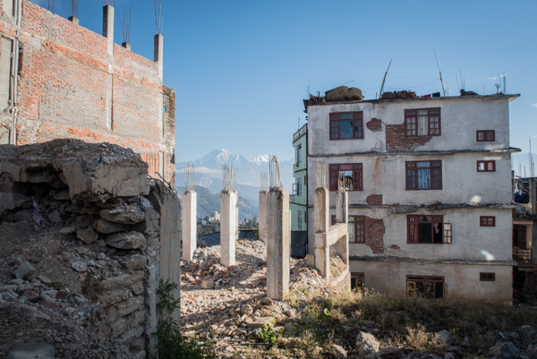
A slow process of reconstruction
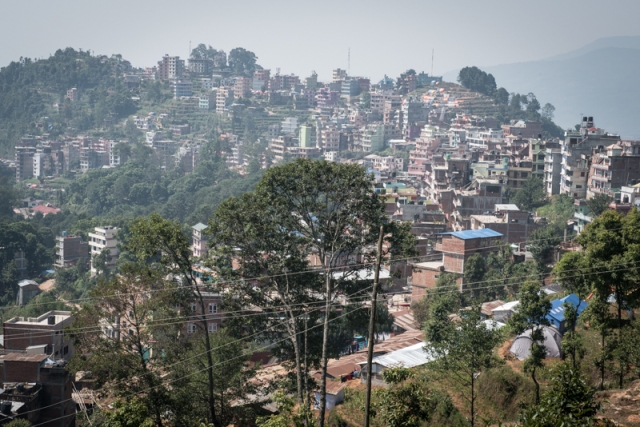
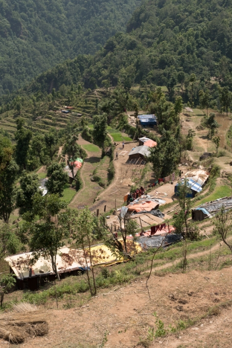
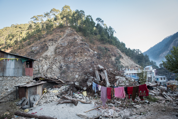
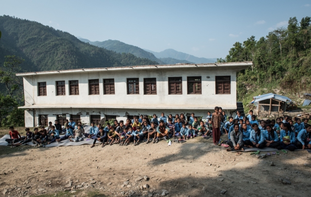
I also returned to a hill on the West side that overlooks the town. Where last year the terraced fields around the fringes had been full of makeshift tarpaulin homes, they have for the most part returned to their agricultural use: but not all. 18 months on there are some facing their second winter living under tarpaulin, and there are thousands who have graduated to home under a single thickness sheet of corrugated tin. Have these people heard about ‘building back better’? or are they simply meeting their shelter needs in the only way they can?
Charikot 18 months ago (May 2015). Note tents in foreground and tarps on terraced hillside
Charikot today. Tarps largely but not entirely absent.
Even last year, when the dirt road North was flowing with Aid vehicles, a short and not so difficult detour changed the scene entirely. I had been directed by Plan International’s District Co-ordinator to, if possible, get to Lapilang VDC (Village Development Committee). It was somewhere they hadn’t managed to get to yet. On my Royal Enfield Bullet (hardly an off road machine) I made the hour detour into a western side valley. It was admittedly harder and slower going, but not by much. Nothing a 4 x 4 couldn’t do comfortably.
I arrived in Lapilang two weeks after it had had 100% of its housing stock destroyed and to my surprise, I learned from the villagers that I was the first outsider to reach them. They had received emergency supplies; these had come in Nepali trucks. The villagers took me on a several hours tour of their village, showing me the remains of their homes, the fissured earth which they feared would yet tumble down the steep hillside to the river far below, and the ghotes (animal shelters) higher up, on safer ground, where most of them were now living in co-habitation with their beasts.
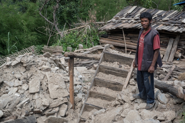
The condition of most homes in Lapilang
The relocated village where people and animals co-habited under tarpaulin
I did what little I could, training them how to use and maintain simple drinking water filters and leaving them with all I had.
The school had been the only concrete building but it had not survived. Only it’s skeleton remained, misshapen. It stands there still, bearing testament to the 45 seconds in which the life of the village shook and changed. Next to it there is now a tin school, hot in summer, cold in winter in which children sit on wooden benches at wooden desks or stomp about in the dust, running amok in the absence of teachers.
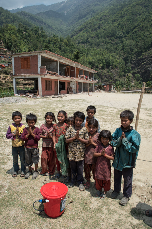
The wreck of the school and a water filter
18 months ago, the community needs where for shelter, food, water. These needs have now been met, to varying degrees. Now a proper school that is their number one priority and hope. But how will this need be met? And how long before temporary (corrugated tin) becomes permanent?
The new school. When does temporary slide into permanent?
The disparity of aid and reconstruction is now one of the most striking and troubling elements of Nepal’s post-earthquake reconstruction. What demarcated the ‘getters’ and the ‘go-withouts’ is plain to see, though an inconvenient truth for those for whom personal gratification is part of the Aid deal (typically along the lines of coming to the aid of a noble Sherpa community, that exists on a trekking route – and thus, a place of natural beauty and already, some wealth – and involving aid worker travel to places tourists have to pay to go)
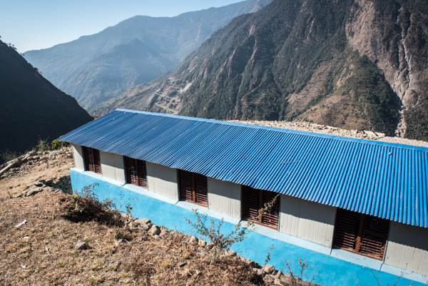
Contrast the new school of Lapilang and Simigaon
Could that disparity be something to do with having or lacking this? (this is the other view from the Simigaon school)
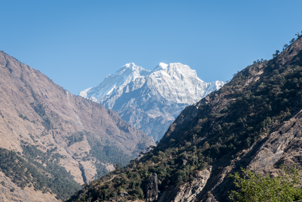
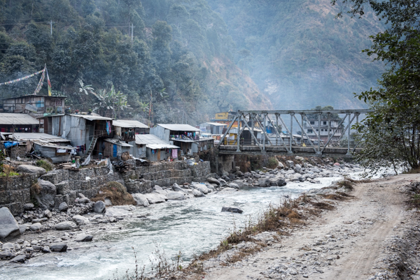
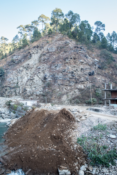
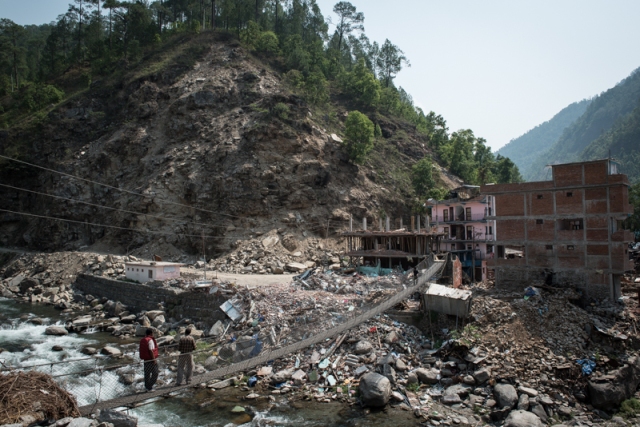
I move now back to the main Tama Koshi valley, to Singati, a transit town on the junction of rivers and routes and where the earthquake caused considerable loss of life, mostly due to multiple collapses of concrete buildings. This is the entry point to the Gaurishankar National Park, a place where tourists show a permit but don’t linger. It has little or nothing of beauty, either natural or man-made with which to endear itself to a tourist or donor.
As scenic as it gets in Singati
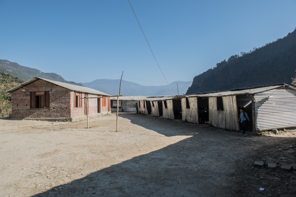
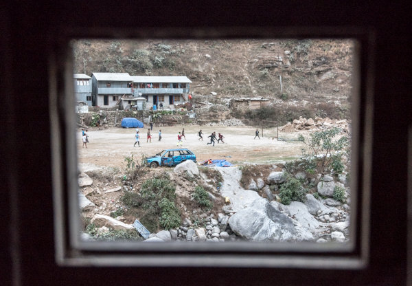
It’s a place where even the football that the kids kick around in the dust is misshapen, where a wrecked car passes for a climbing frame and where 400 children go to school under a single tin roof.
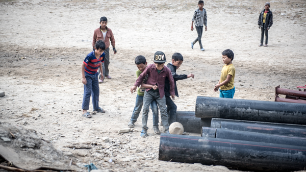
Football (photo credit: a local child)
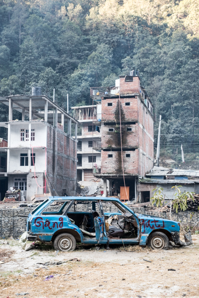
Climbing frame (with my hotel rear right)
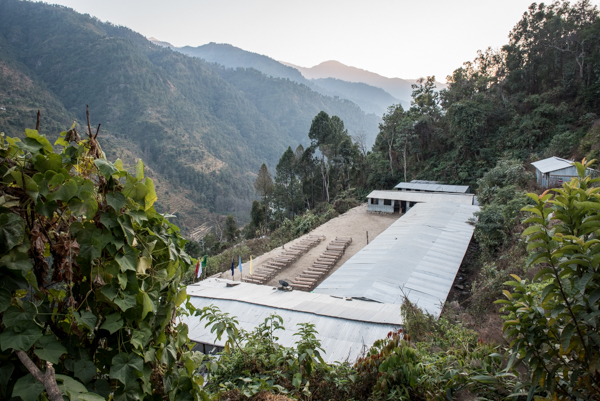
School for 400
What is impressive is the sheer amount of hard graft that is taking place to rebuild. And perhaps it’s a good thing that there is no sign of foreign aid here: no fostering of unhealthy dependence; but are the same mistakes of construction simply being repeated in the absence of funds or expertise for anything that constitutes ‘Build Back Better’?
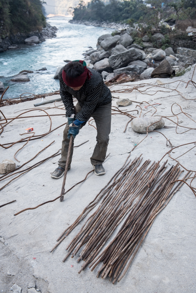
Young men straighten mangled reinforcing rods and cutting to length for re-use
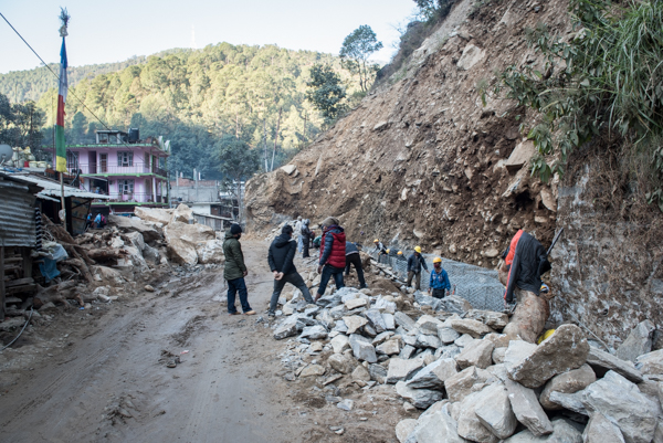
Gangs manually fill wire net with rubble in an attempt to hold back the unstable terrain
The site of a collapsed hotel. More than forty people were killed. For weeks if not months nearly half of the bodies remained in the rubble: digging them out was simply not best use of man power in an emergency
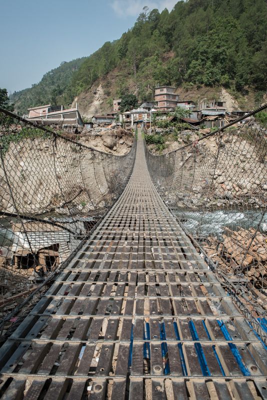
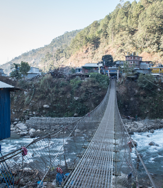
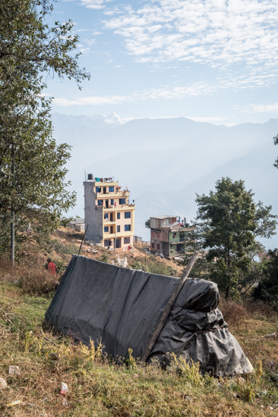
On we travel, another twenty something kilometers up the road, impassable last year due to the many earthquake triggered landslides. I stop at Chhetchhet, leave the bike and climb six hundred vertical meters to arrive at Simigaon, idyll of rural, rustic, Himalayan-view-enjoying, organic village life. This is a very different scene to Lapilang, its similarly rural but mountain view-less cousin. So what’s the single biggest difference? How does Simigaon have numerous buildings of significant size that are still intact? How does Simigaon boast a well built new school? I believe that the single biggest factor is location. It has mountain views. It is in a beautiful location. It has thus become a trekking route. Locals have become comparatively wealthy because of this, both in material wealth but also, critically, in social capital and worldly knowledge. They have forged bonds with foreign trekkers upon whom they can now call, or who come forward to offer their help because it feels good to help that guy whose teahouse they stayed in in that beautiful place with the view of the mountains. And so it goes, the gap widens, the disparity increases. If you want to see it and feel good, there are plentiful examples of ‘Build Back Better’. If you want to see it and feel something different, there is a flip side.
More images:
Singati, 18 months on
Singati, 18 months on
Singati 18 months ago
Singati today
First day back at school post-earthquake (May 2015). The building is unusable and remains so today
Locals contemplate those lost under the rubble of the hotel. Singati, May 2015
A Room with a View. Singati. Note houses of corrugated tin
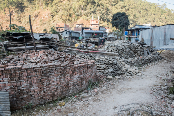
The full spectrum of housing. Charikot. Dec 2016
